
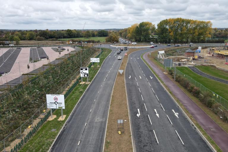
Image: new road layout at Marsh Drive roundabout, Willen Road, Newport Pagnell.
Milton Keynes East (MKE) is a major, large-scale urban extension project allocated in the Council's Plan:MK local plan for a mixed residential and employment development covering 440 hectares of land east of the M1 motorway, south-east of Newport Pagnell, and north of the A422/A509.
The project is a key part of the Milton Keynes City Council's strategy for future growth and will include:
- 5000 new homes
- 105 hectares of employment land (for offices, research and development, and industrial/logistics uses).
- A community hub (local centre) with shops and services, a health centre, three primary schools, and a secondary school.
- Extensive open space, playing fields, and a linear park along the River Ouzel.
To facilitate this development, the Council is planning and building the essential infrastructure now including expanding capacity on the highway network.
The council secured a £94.6 million grant from the government's Housing Infrastructure Fund (HIF) in 2020 to deliver upfront infrastructure works.
The highway schemes will include:
- New roundabout at Marsh Drive, Newport Pagnell (image above) - this was delivered by the developer on behalf of the council.
- New bridge over the M1
- Network of footways, redways and public transport connections